Inferno on the North Rim: Grand Canyon Fire Morphs Into Megafire, Spawns Its Own Weather
The wildfire scorching the North Rim of the Grand Canyon has surged into “megafire” territory, more than doubling in size in just a few days and reaching such intensity that it’s now generating its own weather patterns.
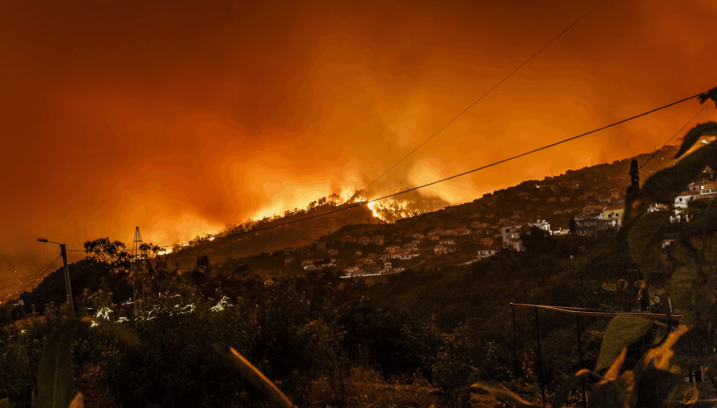
Known as the Dragon Bravo Fire, the blaze exploded in size due to brutal weather conditions—scorching dry heat and fierce winds—that also wiped out much of firefighters’ progress on containment. By Friday morning, officials with the National Interagency Fire Center reported that only 8% of the fire had been contained, as it torched around 112,000 acres since it ignited on July 4. That makes it the largest wildfire currently burning in the contiguous U.S., with a footprint nearly three times the size of Washington, DC.
Once it exceeded 100,000 acres, it was officially classified as a megafire. Data from Inciweb shows the blaze has more than doubled in size since Sunday, when it was around 50,000 acres.
The fire’s rapid growth has been fueled by extremely flammable vegetation, now so dry it’s more dehydrated than kiln-dried wood, according to a Thursday update. These bone-dry fire fuels allow the fire to spread explosively.
Although only about 3% of wildfires reach the scale of the Dragon Bravo Fire, megafires like this are responsible for most of the total acreage burned annually in the U.S.
Sparked by a lightning strike on Independence Day, the fire was initially managed as a controlled burn—a strategy that quickly backfired when it surged out of control a week later. Since then, fire crews have been in an uphill battle to contain it.
Craig Daugherty, Section Chief for the Southwest Area Incident Management Team, said Friday that while some regions have been stabilized, the northern and southwestern fronts remain highly active and concerning.
Tragically, the Grand Canyon Lodge and more than 70 other structures, including cabins and a visitor center, were lost to the flames in mid-July.
Last weekend saw the blaze reach its highest containment level at 26%, but volatile weather since then has reversed much of that progress. The fire has grown so intense that it’s creating its own weather, including pyrocumulus clouds—massive smoke-fueled formations seen hovering above the fire for seven consecutive days, according to fire information officer Lisa Jennings.
These clouds form when extreme heat forces air rapidly upward, cooling and condensing moisture into dramatic cloud formations. When intense enough, they can become pyrocumulonimbus clouds, or “fire thunderstorms,” which generate lightning, winds, and even fire-triggered tornadoes—potentially igniting new blazes.
Even without fire-generated storms, weather conditions remain dangerously unfavorable. While there’s a slim chance of rain through the weekend, any added wind or lightning could worsen the situation more than rain could help.
An extreme heat warning is in effect through Tuesday across the Grand Canyon region, with gusts of 20–30 mph expected to continue into next week—further complicating firefighting efforts.
Despite the calendar flipping to August, wildfire season is still raging strong. The National Interagency Fire Center issued a blunt reminder Friday: “We’re in the heart of summer—and the heart of fire season.” They project the western U.S. will remain the epicenter of wildfire activity through at least September.